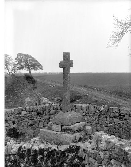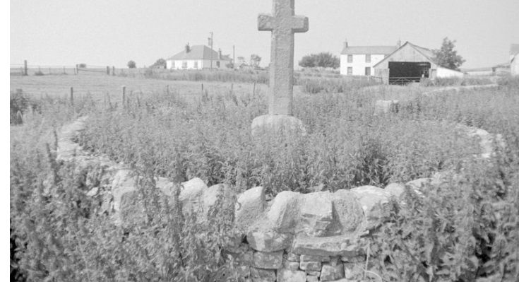
The cross in 1911

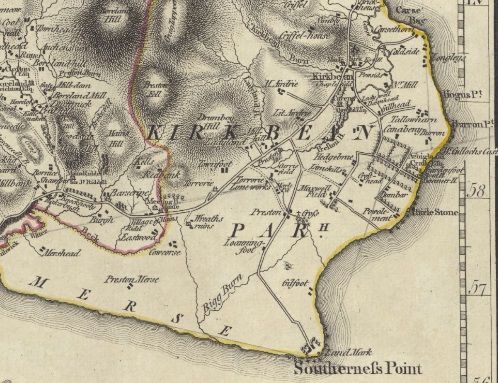
1797 Map featuring the village of Preston

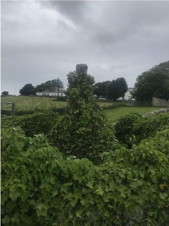
The cross as it looks today
Preston Burgh and the Cross
The Royal Burgh and Village of Preston
The village of ‘Preston’ or ‘Prestoun’ features in a number of sources and maps from at least 1296 onwards however by the mid 18th century it is clear that very little of it remained. In ‘Kirkbean, County of Kirkcudbright, NSA, Vol. IV, 1845’ the village is mentioned:
“... Preston, formerly the property of Lady Glenorchy, distinguished for her piety, there is a stone cross, showing where a considerable village once stood. Some time ago, this village is said to have been inhabited by twenty-four tenants; now it is occupied by only one.”
It can be assumed that the figure of “twenty-four tenants” in this context would mean 24 families rather than individuals, and when family sizes tended to be much larger in the pre-industrial world that this would have indeed been quite a sizable settlement.
The ‘Lady Glenorchy’ mentioned as previously owning the estate upon which Preston stood was Willielma Campbell a viscountess who married John Campbell. Campbell was the eldest son of the 3rd Earl of Breadalbane and Holland, who was at the time one of Scotland's wealthiest landowners. Although the cross here in Kirkbean outdates the Lady, she was very notable for overseeing the construction of chapels across both England and Scotland, some of which still stand today.
Historic Environment Scotland claim on their website that the lost village at one point housed several public buildings and even its own jail. While the exact location of the village is difficult to decipher, especially as the cross has been moved at least once since the disappearance of the settlement, it is generally thought to be somewhere slightly to the north of the steading of East Preston farm where dairy cows from New Mains farm now graze.
Although the waterway that flows through the area where Preston stood is quite small and unassuming it runs through some of the most fertile ground in the parish of Kirkbean, where there is a nice balance between sandy free draining soils of the coast and the heavier ground that sits around the base of Drumbuie hill. It is easy to see how this would have been a good area for people to live in back in the days when arable farming was far more labour intensive and required workers to be as close to the productive fields as possible.
There are another couple of nods to the former significance of Preston in local place names. The first is West Preston farm, just shy of a mile from the site of village, as well as another farm Preston Merse, which although featuring in old maps of the Parish has been abandoned for many years now. Preston Fell appears on a map of the Stewarty from 1797, sitting just up behind Kells farm however it is difficult to see which hill this corresponds to on modern maps. The most notable feature however is the village of Prestonmill which today has around 14 houses and an old blacksmith's workshop. This settlement was built around a mill that ran off the water flowing down Ladyland burn, presumably because the site of Preston itself lacks the gradient for a water wheel.
The Market Cross
The ‘Preston Cross’ is a 6’ 4” high cross made from a single piece of yellow freestone with chamfered corners. It is currently mounted on to a granite plinth with 3 steps leading up to the cross and surrounded by a small dry stone dyke that was erected to protect the cross from agricultural machinery.
It is unknown exactly how old the Preston Cross is however it is first referenced in literature in the 1795 work ‘Kirkbean, County of Kirkcudbright, OSA, Vol. XV’ :
“A cross, of about 7 feet in height, raised on a base of stone wall, about 4 feet square, is still standing.”
At some point after this was written and before 1850 the cross was lost, buried somewhere nearby. There is no clear evidence as to why this happened, however it has been suggested that it was removed by the authorities to prevent it from becoming a gathering place for local peasantry to convene and protest against the enclosure of arable land into pasture for cattle grazing. This was a common grievance of rural people across Britain from the 1530s onwards as land that was used for common grazing and shared by all people in a community was enclosed, often by hedges, into smaller fields that the local member of the landed elite would then rent out for a fee. It is funny to think that hedgerows which are looked upon so fondly today as quintessential elements of the British countryside were once seen as an oppressive method of land misappropriation.
In 1850 the cross was dug up again and placed in its current position just south of East Preston Farm on the road down to Southerness.
It is actually not entirely clear what the purpose of the cross was when it was first constructed. The generally accepted opinion is that it functioned as a market cross for the royally sanctioned fairs that occurred 4 times annually, however these privileges had ceased by the time of the cross’ mention in the 1795 source.
Today the cross stands as the only remaining element of what was once a significant and long lasting settlement.

